What Happens in the Arctic Doesn't Stay in the Arctic
Of the more than 4,000 exoplanets astronomers have identified since the mid-1990s, only about a dozen are the right size, composition, and of a sufficient distance from their home star to earn the label "Earth-like." Extrapolated across all the stars in all the galaxies, as many as 40 billion habitable worlds may exist in the known universe.
As of press time, however, only one world is confirmed to harbor life: ours. Which is why NASA has launched hundreds of Earth-facing satellites over the past 60 years, each employed at cataloging some facet of the unique biosphere. And with Earth's rising temperature threatening organisms great and small, scientists need satellite data of things like rainfall, ozone, and ocean circulation to figure out what life on this planet will look like in the near future. NASA's newest probe—launched last September—looks at ice.
The appropriately named ICESat-2 measures the thickness of terrestrial glaciers and floating sea ice using an innovative, super-precise instrument called ATLAS. ICESat-2's ground team has been furiously processing its returns, and recently published the first dataset. Scientists will use this data to understand how glaciers behave as they melt, where sea ice is thinnest, and what the progressive loss of both means for sea levels and temperatures around the world.

Artist rendering of ICESat-2. Credit: NASA
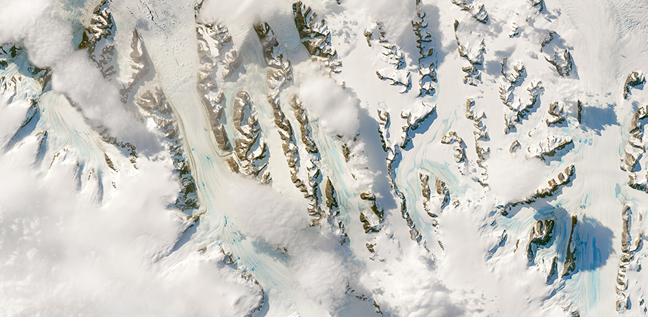
The gigantic glaciers covering Greenland, Antarctica, and to a lesser extent, parts of Canada and Russia hold the bulk of Earth's fresh water. Even more critically, they determine the shape of coastlines on every continent. Floating sea ice fluctuates in size from season to season. As the Northern Hemisphere tilts towards the sun each summer, the frozen cap covering the Arctic Ocean thins and thaws. But, in the Arctic, a sizeable fraction of sea ice persists from year to year. This so-called multi-year ice drives weather patterns across the Northern Hemisphere, and longer-term climate around the world. "What happens in the Arctic doesn't stay in the Arctic," says Tom Neumann, a cryospheric researcher who leads NASA's ICESat-2 science mission.
Ice has a high albedo, reflecting up to 70 percent of incoming sunlight back out to space. Conversely, open ocean water only reflects about 6 percent of sunlight, absorbing the rest. So, the size of the Arctic ice cap determines the total amount of solar energy Earth absorbs each day. Over the season, the Arctic's day-to-day temperature creates wind patterns that influence weather many thousands of miles to the south. Compounded over the years, the extra heat absorbed by the ocean contributes to general warming patterns all over the world.
Peering into the Poles
Scientists owe much of what they know about polar ice to satellites. Probes equipped with optical, infrared, even gravity sensors have helped them understand the rate and total extent of loss over the years. Additionally, weather satellites give them the ability to connect the dots between ice and phenomena like polar vortexes and jet stream fluctuations.
However, one of the big holes in these data concerns the variable thickness of ice on both land and sea. For glacier ice, it's challenging to get a grasp on how fast (or slow) glaciers are melting without frequent updates to their elevation maps. For oceanic ice, scientists need thickness data of the ratio between first-year ice and multi-year ice to predict how much sea ice will survive each summer.
Collecting thickness data is tough, though. NASA and other agencies have flown countless airborne lidar missions-with the laser apparatus attached to an airplane-but these have high fuel costs and require lots of flights to collect even a fraction of these gigantic land masses.
Space-based lidar missions can collect more data more efficiently, but come with their own challenges. For one, they have to be virtually fail-proof in an environment that is exponentially more hostile than anyplace an airplane might fly on Earth. For instance, this means engineers must design sensors that can accurately track returning photons down to the trillionth of a second when daily temperatures swing between −148˚F and 248 ˚F. If a laser blows a fuse or the GPS tracker goes out on an airborne mission, that might ruin a day's worth of data. If a space mission starts flying blind, you can say goodbye to years' worth of work and millions of dollars of equipment.
The Lidar Learning Curve
ICESat-2 is, as the name suggests, a sequel mission. The first ICESat launched in 2003 and came (carefully) crashing down into the Barents Sea in 2010. From the start, it had a troubled run. Just a few months after launching, corrosion in the pump diodes caused one of the three lasers in the lidar apparatus—called GLAS, short for Geoscience Laser Altimetry System—to fail. Even with two backup lasers, the ICESat team wasn't taking chances. They modified the mission, turning on GLAS for one month at a time every three or six months rather than operating continuously as planned.
Despite its operational limitations, GLAS revealed some vital science to the team. "It showed that the outlet glaciers near the edge of the ice sheets were much more dynamic than we originally thought," says Neumann. These revelations helped cryo-scientists make better estimates of how the melting happens—as outlet glaciers change shape, they cause interior ice to shift.
But the data-gathering potential of ICESat was limited by its design. It fired in a single beam with a footprint roughly 70 meters in diameter at roughly 150 meter intervals along its track. If ICESat had flown over an American football field, it could take just one measurement at each end zone.
In addition to the large gaps between measurements, ICESat had limited ability to show changes in ice over time. To measure ice loss in glaciers, scientists have to compare two passes, taken months or years apart. However, ICESat only had that single beam, and couldn't perfectly retrace its steps each orbit. "So if the second pass showed a decline in elevation, but was a few meters to the left or right of the original track, you would have no way of knowing whether you had measured real ice loss or just the angle of a slope," says Neumann.
The instrument had trouble at sea as well. Over a season, ocean currents, surface wind, and solar warming create open spots—called leads—amid the sea ice. If you remember anything from your repeated viewings of Titanic back in the 90s, only about 10 percent of sea ice mass floats above the surface. Multi-year ice (which is far less likely to melt away each summer) will be thicker and float higher above the ocean. Leads provide scientists a window into how far above sea level ice is floating amid otherwise unbroken floating sheets-thereby allowing them to estimate the ratio of first-year to multi-year ice covering the Arctic.
Although the 70-meter footprint of ICESat was small for its time, it wasn't tight enough to capture all the detail the team wanted for floating sea ice. Lidar units that spread their pulse energy over a wider area tend to have more beam divergence. This leads to a lower signal-to-noise ratio. "Lots of leads are in the ~25-meter wide range, so to get a measurement of the sea surface height in that lead, you have to have a smaller footprint," says Neumann.
Engineering for More Data, More Detail
Despite the setbacks and limitations, the original ICESat yielded a bonanza of polar data. In 2007, when the National Science Foundation was making its recommendations to NASA for the next 10 years, it prioritized orbital, Earth-facing lidar.
"We started off with a requirement for smaller beams in parallel pairs," says Neumann. The tighter focus would allow the sensor to pick up small leads, and the paired beams would eliminate any ambiguity over whether the satellite was looking at sloping glacier or one that was melting. Originally, the design specs called for 16 beams—quite a big jump from one single shot! However, each additional beam complicates the design of every other subsystem on the unit. "Now you've got more data streams to process. You have to align all these beams so they can be collected by the telescope," says Neumann. The estimated cost of calibrating all this complexity caused the team to recalibrate their ambitions. They scaled down to six paired beams and called it ATLAS—short for Advanced Topographic Laser Altimeter System.

A technician checks the flight door for the ATLAS on NASA's ICESat-2 on 21 June 2018. Credit: NASA
In the time since the original ICESat launched, technologies for lidar, computing, and satellites had all advanced significantly. The first ICESat's GLAS sent out just 40 pulses each second. When you calculate the photon bounce—back rate-between one and ten for each pulse—that's actually not a lot of detail.
On the other hand, ICESat-2 fires 10,000 pulses each second in each of its six beams. The footprint of each beam is around 15 meters in diameter, and it gets a return every 70 centimeters, which is about 130 measurements between the two end zones of a football field.
This dramatic jump is thanks to the way the newer satellite counts the returning photons. The original ICESat used a full-waveform lidar. Each pulse was about six nanoseconds long, and the satellite's onboard detector would measure the intensity of the returning waveform. This approach limits the number of pulses you can send per second.
The improved computers aboard ICESat-2 allow it to count individual photons as they come crashing in. Neumann compares it to tagging salmon. "The system catches one, tags the time it picked it up, then files away that data for processing later," he says. The only other data needed is the location and elevation of the satellite relative to Earth at the time the photon's pulse was fired and when it was recaptured.
Extending the salmon analogy, ICESat-2 uses a fine-mesh net. Its lasers pulse at 532 nanometers, and the satellite's 76-centimeter telescope only allows for the tiniest deviation from that wavelength in photons it picks up. That's good gatekeeping from riff-raff across the rest of the electromagnetic spectrum, but it doesn't catch all the 532-nanometer photons emitted by other light sources. Namely, the sun. "When the sun is high in the sky, and you have fresh snow, you'll pick up around 5 million photons at 532 nanometers coming from it per second," says Neumann. That might sound like a lot, but it's only one photon every 10 meters. Solar photons are pretty easy to filter out by graphing their time of collection alongside that of photons fired by ICESat-2. The satellite's points will look like a thickly etched line (a profile of the ground below), while the solar photons are noise surrounding it.
ICESat-2 also realized a massive jump in accuracy. Its designers outfitted it with what they call the Laser Reference System. It tracks the satellite's roll, pitch, and yaw. However, rather than using accelerometers for the job, like an inertial measurement unit (IMU), it uses backward-facing cameras to compare the stars behind ICESat-2 to the exact point on Earth its laser is firing (as determined by GPS). In fact, for redundancy's sake, ICESat-2 also has IMUs and two backup star cameras. ICESat-2's original specs called for pointing control within 45 meters of its previous track. Performance so far is within 10 meters.

ATLAS uses three pairs of beams, 90 meters apart, with a reference track between the beams. On following passes, even if the two beams are slightly upslope or downslope from where they were on the first pass, scientists can still calculate the elevation change of that track. A visual breakdown of ATLAS "by the numbers" can be seen on YouTube. Credit: NASA/YouTube
"It's insane to me that any of this works at all," says Neumann. "When we first turned it on last October, a couple of folks stayed up all night processing the return data. I tried to sleep, but woke up at 4 a.m. to check my email." His reaction to the successful readouts in his inbox isn't printable, but suffice to say he was elated. A few months later, in December, he presented the satellite's preliminary processed data to the American Geophysical Union Meeting in Washington, DC. It showed previously unmapped Arctic valleys, remote ice sheets, forest canopies, even shallow coastal waters in the tropics—data the green laser picked up while transiting between the two poles.
Neumann expects even more significant results when his team publishes its first publicly available data. Cryospheric scientists around the globe will be able to make unprecedented measurements of polar ice sheets. And that's not counting what applications ice-centric disciplines will find for the data. Because, unlike its predecessor, ICESat-2 will remain operational all the time, capturing photons from forests, cities, and other landscapes.
"Stay tuned," says Neumann. "Creative people are going to take these little points of latitude and longitude and turn them into knowledge you've never even thought of."
Nick Stockton is a freelance writer based in Pittsburgh, Pennsylvania. He contributes to WIRED and Popular Science.
| Enjoy this article? Get similar news in your inbox |
|