On-the-Fly Filtering System Improves Weather Sat Image Alignment
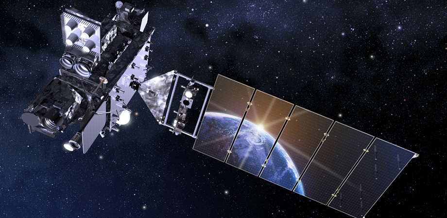
Satellite imagery is a crucial aspect of modern life. For instance, crop growth and yield estimates are partially derived from satellite imagery. Likewise, air quality, deforestation, and, of course, the weather. Some of the technology that goes into satellite imaging is obvious: you need good hardware, like a big mirror on the telescope, a large sensor with lots of pixels, and a nice stable platform, like the geostationary operational environmental satellites-R (GOES-R).
What isn't so obvious is the software side. To track a weather system, for instance, satellite images need to be aligned. The Earth's spherical surface is mapped to flat plane with a fixed grid and each pixel in a satellite image should correspond to a known grid position.
It's just a trig problem, right?
At first glance, this seems like a relatively simple problem: given a page of trigonometry and a willing intern, the problem is solved, right? Well, no. It turns out to be quite a difficult problem, especially if you desire information more specific than "not in Kansas anymore." In a recent publication in the SPIE Journal of Applied Remote Sensing, Bruce Gibbs from Carr Astronautics turned his attention to increasing the accuracy of imaging from GOES-R. It is not often that filter design takes center stage in research, but this is one of those occasions.
Even though the GOES satellites are geostationary, they are not stationary, which presented a problem to the team in charge of the advanced baseline imager (ABI). The satellite position, the orientation of the satellite, and the mirror of the ABI shift around constantly. The latter is especially troublesome when Earth eclipses the sun, allowing the mirror to rapidly cool.
To put it in perspective, the ABI is supposed to have a resolution of 0.5 km for images using visible light. But, a geostationary orbit is about 36,000 km above the Earth's surface, meaning that the orientation needs to be known more accurately than 0.0008°. To achieve this, the stars are used to determine orientation. The ABI takes a picture of a star field, and uses the positions of the stars from a catalogue, in combination with its own orientation sensors to determine its exact position and orientation with high accuracy. This information is then used to align images.
In an ideal world, this works, but all measurements have noise associated with them. To reduce the filter noise, instrument and satellite designers used the expected operational parameters of the equipment to create a pre-programmed Kalman filter. Unfortunately, the filter's performance was disappointing.
No filter for the faint hearted
Kalman filters are usually explained as follows "the Kalman filter mumble mumble residuals mumble mumble least squares mumble mumble measurement data mumble mumble and, as you can see, the result has reduced noise." In this case, a model of the satellite motion, rotation, and mirror deformation is used to estimate a new orientation and position of the satellite, based on the last known position and orientation. Measurements are also used to estimate the position and orientation. The estimated position and the measurement data are averaged to produce a more accurate estimate of the position and orientation. This new position becomes input for the next estimate.
The magic is in how the measurement data and the model data are averaged. This is not a straightforward process, with some thirty-odd parameters to be adjusted. Thus, the Kalman filter, as supplied, did not perform as expected. However, the more unpleasant surprise was that hand-tuning the filter also did not work. In the end, it was determined that the filter parameters would have to be determined on-the-fly, rather than using some fixed (but regularly updated) parameter set.
The result is a Kalman filter that determines how it combines model and measurement data via a statistical minimization process. The minimization is achieved by examining the correlation (more precisely, the covariance) in the noise between the different parameters. An optimized parameter set will minimize the covariance (meaning that the filter parameters are maximally independent of each other). Hence, a very difficult, multidimensional problem was reduced to a sequence of one- or two-dimensional minimization procedures.
Comparing the two filters, Gibbs showed that the orientational noise was reduced 40-50 percent to about 0.0002°. The proof, however, is in the imaging data. By applying the filter to images obtained in 2017, Gibbs was able to convince the instrument operators to adopt the new filter design.
Read the original research article in the Journal of Applied Remote Sensing: Gibbs, "Improved GOES-R ABI image navigation and registration using maximum likelihood parameter estimation," J. Appl. Remote Sens. 14(3), 032404 (2020). doi: 10.1117/1.JRS.14.032404
| Enjoy this article? Get similar news in your inbox |
|


